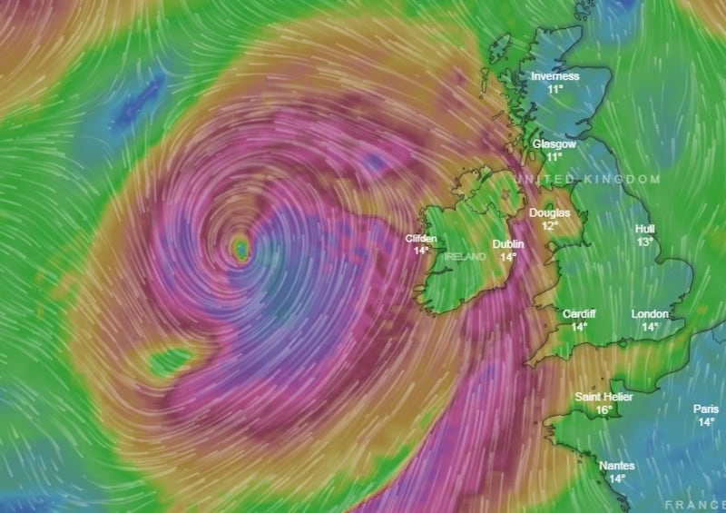
The National Emergency Co-ordination Group has warned the public to stay away from coastal areas until the lifting of a Status Orange weather warning overnight and through today as Storm Callum hits Irish coasts .
The group met yesterday as fears mounted that the storm’s high winds gusting up to 130km/ph, combined with spring tides, could cause serious flooding along the south and west coasts.
The group, made up of officials from state agencies including the Office of Public Works, Met Éireann, the Department of Defence and the Coast Guard, urged people to "be aware of local conditions [as] their impacts can vary significantly from place to place".
Met Éireann issued Status Orange weather warnings for 13 counties – Dublin, Louth, Wexford, Wicklow, Meath, Cork, Waterford, Donegal, Galway, Mayo, Sligo, Clare and Kerry. It said warnings would remain in place from 11pm last night until 5pm this evening in Donegal, Galway, Mayo, Sligo and Clare and until 9am this morning for other counties.

"The strongest winds will be all around the coast of Ireland but with a particular emphasis on Atlantic coastal counties and there will be rain accompanying it too," Met Éireann meteorologist Siobhán Ryan said and she highlighted the potential for stronger gusts locally.
The Department of Education said schools should “err on the side of caution” when considering whether to remain closed today.
"Schools and all education centres in areas affected by a status orange alert should remain vigilant, and keep themselves appraised of any hourly and other updates from Met Éireann, and from their local authorities, local radio, and an Garda Síochána, " it said.
Crisis management teams and local coordination groups were activated in coastal counties affected by the warning and local authorities were monitoring the developing situation and making necessary preparations.
Preparations
In Galway City a temporary 80m "aquadam" was installed at the Spanish Arch on the river Corrib estuary, while flood gates were installed at Toft carpark in Salthill. Sandbags were made available for collection at several locations, and a number of roads and carparks will be closed from 8pm last night until further notice.
Dublin City Council closed tide gates at Merrion Gates and said on-call crews would be available to clear any debris. Cork City Council has issued a warning to pedestrians and motorists to avoid low-lying city quays on Friday morning over fears they could experience localised spot flooding during high tides.
Wexford County Council's crisis management team met and agreed to erect flood defence barriers in Wexford, New Ross, Arthurstown and Ballyhack and the filling and stockpiling of 5,000 sandbags for use if needed in Enniscorthy.
The Road Safety Authority asked road users to exercise caution. The public was warned against visiting national parks, monuments and nature reserves during the storm by the National Parks and Wildlife Service. The Coast Guard warned people to stay away from exposed beaches, cliffs and piers, harbour walls and promenades.

Civil Defence personnel and equipment are on standby and there will also be continuous cleaning of gullies and shores to minimise local flooding. Fear of power outages across the State prompted ESB Networks to put in place a full emergency response.
The National Emergency Co-ordination Group said cold weather plans had been implemented in Dublin and other urban centres and outreach teams were on the streets overnight to engage with rough sleepers. It will meet again today to review the impact of the storm and to coordinate any response necessary.
Met Éireann said conditions should abate fairly quickly on Friday afternoon with drier weather developing for a time. Another spell of very heavy, possibly thundery rain will push northwards later on Friday, and rain will be widespread on Friday night and for a time on Saturday but turning drier and fresher later in the day and overnight.


