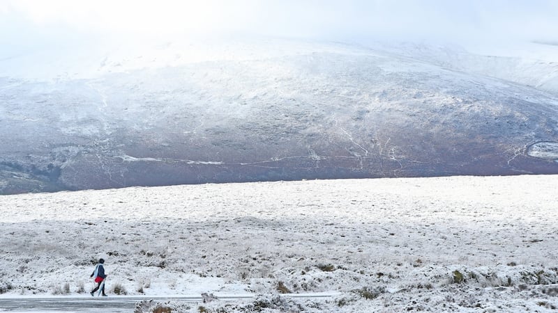
There will be showers of hail, sleet and snow across the country this week with the possibility of “significant accumulations” on Tuesday evening and overnight.
Met Éireann has issued a yellow weather warning for all parts of the country from 6am on Tuesday until midday on Saturday.
The Dublin Region Homeless Executive (DRHE), which coordinates the four Dublin local authorities' homelessness response, activated its extreme weather protocol on Tuesday.
0 of 5


Cold and blustery today with a mix of sunny spells and scattered wintry showers. The showers frequent over the western half of the country with falls of snow expected. Maximum temperatures of just 2 to 5 degrees in fresh and gusty westerly winds. pic.twitter.com/4qDFgscf1K
— Met Éireann (@MetEireann) January 29, 2019
The executive said extra emergency beds would be made available for rough sleepers during the period of adverse cold weather.
Met Éireann said snow showers will be frequent across the southwest, west and north, where “some significant accumulations are possible” on Tuesday night. There is also the potential for further significant snowfall in places on Thursday.
Emergency Beds
In a statement, a DRHE spokeswoman said it was aware the risk of forecast snow and hail posed for “people exposed to the weather.” The executive was putting in place contingency plans to cope with increased demand from rough sleepers presenting to homeless services.

Speaking in the Dáil, Minister for Housing Eoghan Murphy said there would be emergency beds for "everyone who needs a place," throughout the coming cold snap. "Extra outreach teams will be out to get people in, because of the cold weather we'll experience over the coming nights," he said.
Wintery showers will be frequent over the western half of the country on Tuesday with snowfall expected. Some of the showers will be heavy with the risk of hail and thunder in Atlantic coastal areas. Highest temperatures will be between just two and five degrees.
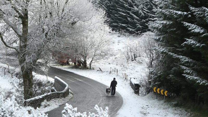
Wednesday will begin cold and frosty with snow lying in some areas. It will be a cold and bright day with sunny spells and a few wintery showers. The showers will tend to become isolated later in the day with highest temperatures between two and six degrees.
Rain, sleet and snow will affect much of the southern half of the country on Wednesday night which will continue on Thursday. Met Éireann said the northern half of the country will remain “largely dry”. Highest temperatures will be between one and four degrees with severe frost on Thursday night.
Friday is expected to be a dry, bright and cold day with a few showers in the west and north but the bulk of the country will remain dry. There will likely be further severe frost over Friday night into Saturday, which for the most part will be frosty during the day, but dry and bright.
AA Roadwatch has reminded drivers that stopping distances are 10 times longer in ice and snow, and that “gentle manoeuvres are the key to safe driving”.
Scotland
The Met Office has issued warnings for snow and ice for large parts of the UK, with up to four inches of snow expected to fall on higher ground as temperatures drop.
A weather warning for snow and ice in south and west Scotland and north-west England, was in place until midday on Tuesday while another warning covering the western side of Scotland and into north west England was also in effect until 12pm on Tuesday. A warning is in effect for the central regions, Wales and the north east between 12pm Tuesday and 11am on Wednesday, and the south east, East Anglia and London from 9pm on Tuesday until 12pm on Wednesday.
Another warning of potential heavy snowfall in the south-east, the Midlands and East Anglia will be in effect from 9pm on Tuesday until midday on Wednesday.
In the US, a polar vortex in the Midwestis to bring the most extreme cold in a generationwith preparations under way for a deep freeze, with lows of minus 30 forecast for Chicago.


