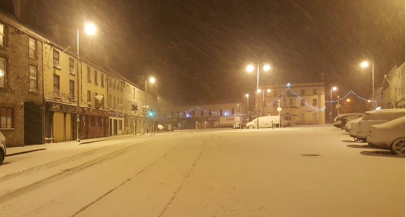
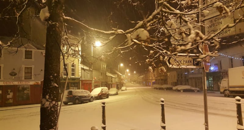
Heavy snow made driving in many parts of the country treacherous on Sunday, with freezing conditions expected on Sunday night.
- Want to have your picture published on irishtimes.com? Send us photographs of snow in your area by emailing newsdesk@irishtimes.com.
Met Éireann had three weather warnings in place for different parts of the country on Sunday. A status orange snow-ice warning was in place for Carlow, Kilkenny, Laois, Longford, Wicklow, Offaly, Westmeath, Meath, Galway, Mayo, Roscommon and Tipperary. The alert came into effect at 11pm on Saturday and was valid for 24 hours.
Snow falling above Carlow in slo-Mo pic.twitter.com/gusonBQagx
— Carlow Weather (@CarlowWeather) December 10, 2017

After significant falls on Saturday night, the national forecaster said snowfall continued on Sunday, clearing southwards during the evening. It said there would be "accumulations of 4 to 8cm with greater totals possible. Drifting snow locally at times too with brisk winds. Severe frost and ice following. Slippery paths and treacherous roads also due to snow accumulation and ice."
A low temperature warning was put in place forecasting extremely low temperatures on Sunday night, with lowest temperatures of -2 to -8 degrees, coldest in east Connacht, Leinster and Ulster. That warning is in place until Monday morning.
A third yellow snow-ice warning was in place for Wexford, Clare, Kerry, Limerick and Waterford until 10pm.

An Garda Síochána issued a statement on Saturday night advising motorists to take extra care due to poor road conditions. It advised those living in areas affected by the orange warning to exercise extreme care travelling and to avoid unnecessary journeys.
"Motorists should clear the windows and mirrors of your vehicles before you set off on your journey and carry a screen scraper and de-icer. Do not use hot water on the windscreen as it can crack the glass," said the statement.

Assistant Commissioner Michael Flynn said: "Please be aware that visibility is reduced in snowy conditions so drive slowly if you need to make a journey.
"Allow extra distance between you and the vehicle in front. Motorcyclists/Cyclists should not comprise their safety by their 'need' to travel in icy/snowy conditions. Be safe."
Travel conditions
AA Roadwatch has advised motorists that stopping distances in the current conditions are 10 times longer. The following roads have been affected:
Galway: The Loughrea/Ballinasloe Road (R446) is impassable in places due to snow and icy road conditions. Gardaí advise using an alternative route. There are also reportedly poor conditions in the Portumna area.
Laois: There is thick snow on the N77 Kilkenny/Portlaoise Road outside Portlaoise. Gardaí are reporting poor conditions too around Stradbally.
Offaly: Gardaí advise caution on the N52 Birr/Tullamore Road due to snowy conditions.
Kilkenny: The Thomastown/Graiguenamanagh Road (R703) is almost impassable due to heavy snowfall. The hill at Bennetsbridge towards Danesfort is almost impassable. Road users are asked to avoid the area and take an alternative route.
Mayo: There are reports of particularly bad road conditions across the county due to snowfall, especially in Bonniconlon, Crossmolina, Foxford and Swinford. Gardaí are advising motorists to slow down and drive with care in these areas. There are poor conditions on the N5 Westport/Castlebar Road at Sheeane due to snowfall. Gardaí are advising that extra care is needed on this route. Gardaí advise that road conditions on the N26 Swinford/Ballina Road are particularly bad due to heavy snowfall.
Waterford: There are slushy conditions on roads around Tramore and Waterford City after snowfall earlier this morning.
Westmeath: We have reports of heavy snowfall in the areas of Mullingar, Moate and Athlone affecting routes in those areas.
Wicklow: The Sally Gap (R759) and approach roads in the area are impassable due to snow and ice.
Irish Rail
All trains are operating on all routes. There are delays up to 25 minutes between Dublin and Waterford (snow affecting points in Carlow) and between Dublin and Galway (snow in points at Woodlawn and Ballinasloe).
Flights
On Sunday, a Dublin Airport spokesman said: "Dublin Airport is fully operational today, however due to the knock-on impact of snow at some UK and continental European airports, airlines cancelled 15 departures from Dublin today."
The cancellations are:
• Ryanair cancelled three flights to Stansted, two flights to Luton, and a flight to Amsterdam.
• Aer Lingus cancelled four flights to Birmingham, a flight to Heathrow, and a flight to Amsterdam
• Lufthansa cancelled a flight to Frankfurt
• Eurowings cancelled a flight to Dusseldorf
• British Airways cancelled a flight to Heathrow
“The snow also caused the cancellations of a number of services to Dublin from UK and continental European airports,” the spokesman said.
These are:
• Birmingham Airport - three flights
• Luton Airport - two flights
• Stansted Airport - two flights
• Heathrow - two flights
• Amsterdam - two flights
• Frankfurt Airport - one flight
• Dusseldorf Airport - one flight
“To put those cancellations in context we have about 278 departures today, so the bad weather in Britain and continental Europe affected about 5 per cent of departures,” added the spokesman.
In a tweet, Dublin Airport said: "If you're a car park customer who has been delayed at a British or continental European airport due to snow there, you won't be charged any extra for your parking. Contact parkingdublin@daa.ie or call 01-9440440."
A Ryanair spokesman said: "Due to snow-related runway closures at several UK airports (including Birmingham, Luton, Manchester and Stansted) we regret we've been forced to cancel a number of flights today [December 10th]. All affected customers have been contacted by email and SMS text message and advised of their rebooking options. We advise customers to check the status of their flight on the Ryanair.com website before travelling to the airport."
Outlook
Met Éireann said: "Severe frost and ice on Monday morning with treacherous conditions on roads and footpaths. Frost will linger in sheltered areas for much of the day. It will be bright with sunny spells. Scattered showers of rain and sleet will affect parts of Ulster, Connacht and west Munster. Highest temperatures of 2 to 7 degrees with fresh north to northwest winds."
Monday night: Very cold with lowest air temperatures zero to -4 degrees with icy patches and lying snow in places. A mostly dry and clear night. There will be moderate to fresh northerly winds.
Tuesday will have a dry and sunny start but cloud will thicken from the west bringing rain during the afternoon and evening with sleet over high ground. Daytime temperatures on Tuesday will be 4 to 7 degrees over Ulster and Leinster and 8 to 10 degrees over Connacht and Munster.
Cool and windy on Wednesday with heavy showers.
Thursday and Friday: Cold and windy with sunny spells. Heavy wintry showers in the west, north and parts of the midlands.
Emergency meeting
The National Emergency Co-ordination Group convened on Friday in anticipation of severe conditions over the weekend.
In a statement it said heavy rain moving up from the south of the country could lead to localised spot flooding before hitting very cold air and turning to snow.

“Most areas of the country will experience either heavy rainfall or heavy snowfall on Saturday night [and/or] Sunday,” it said.
The meeting was organised to review the preparations, particularly in the transport sector, for the change in the weather.
As well as salting roads, local authorities were to activate their severe weather assessment teams to work over the weekend.
The Department of Housing, Planning and Local Government and local authorities are operating cold weather initiatives for rough sleepers, specifically ensuring additional temporary bed space is made available.
The co-ordination group advised the public to follow updates in the media and online as driving conditions could be difficult until Monday. It also urged people to avoid higher altitude areas where possible.


