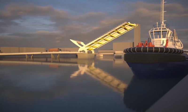
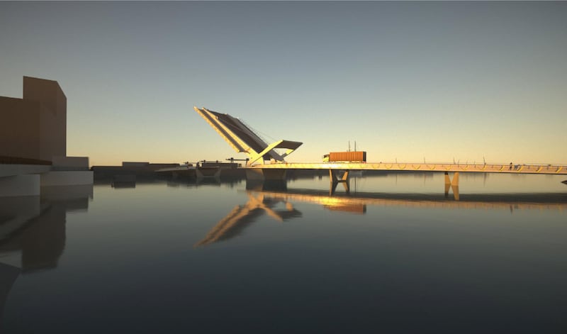
Major redevelopment plans for Dublin Port, including a new bridge across the river Liffey to carry lorries, cyclists and potentially a Luas line, will be published today.
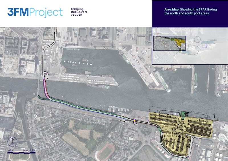
The bridge and a new 2km road built over the sea on the southside of the river are central to Dublin Port Company’s plans to develop its lands on the Poolbeg peninsula and take port traffic, particularly heavy goods vehicles, off the Tom Clarke/Eastlink Bridge.
The project, which the port company is calling 3FM, is the final part of its 2040 master plan to use the port lands to their full capacity, and is the element of the master plan likely to have the largest public impact.
The 3FM project follows on from the first two master plan phases, which were focused on the port lands north of the bay – the Alexandra Basin Redevelopment which is nearing completion and MP2 – designed to provide capacity for larger vessels in the north port, which has recently commenced construction.
READ MORE


The new project will significantly increase port activities on the company’s southern lands at the Poolbeg peninsula with the development of the largest container terminal in Ireland in front of the ESB’s Poolbeg Power Station. This terminal will have the capacity to handle 353,000 containers annually – more than twice the number of containers handled in all other ports in the country last year.
The relocation of container traffic to the east of the port will allow the construction of a new roll on/roll off terminal just north of the Sean Moore roundabout. This 12.6 hectare site will take trucks with containers for the increasing volumes of traffic coming directly from Europe post-Brexit. A 325m ship-turning circle in front of Pigeon House harbour will also be built to allow 240m-long ferries – the largest class of vessel – to turn.
The new road and bridge, which will be to the east of the Tom Clarke Bridge, will take large lorries off local roads by providing a dedicated route for port traffic, but will also carry other heavy goods vehicles such as bin lorries travelling to the Ringsend incinerator.
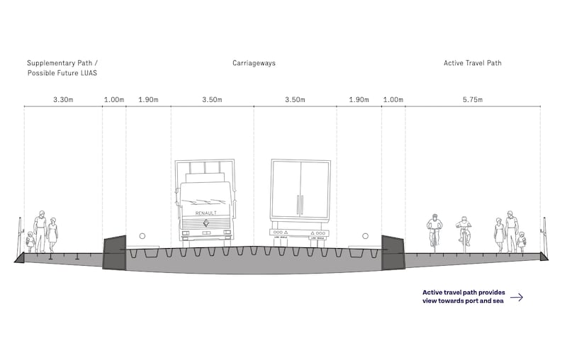
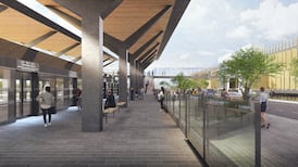
However, its greatest impact for Dubliners is likely to be in its capacity to open the port lands to the public with more than 16km of cycle and pedestrian paths linking the north and south port lands, as well as the ability to carry a Luas line to serve future housing developments at the old Glass Bottle site on the Poolbeg peninsula.
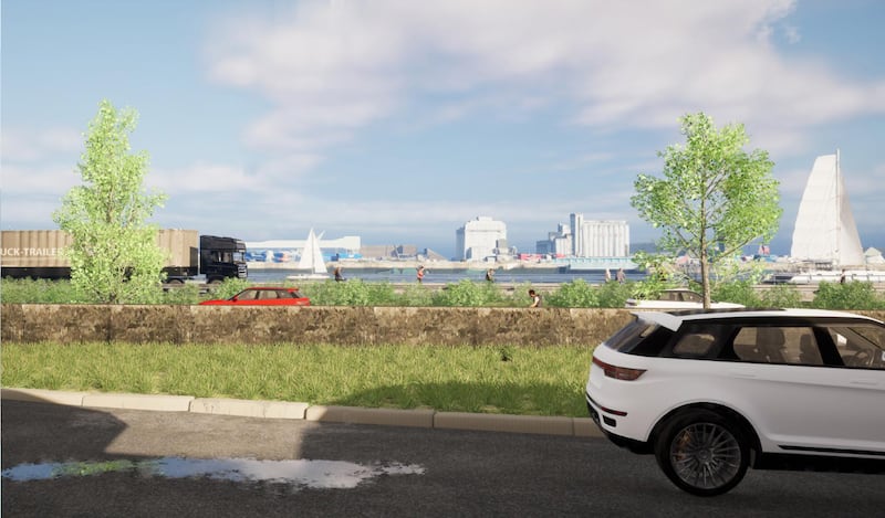
“It is our first opportunity to really open the port up to people, and that is very exciting,” Dublin Port chief executive Barry O’Connell said. “I’m driving in every day and I see a grey wall with razor wire but when I’m actually inside and I see the port and experience it and see the ships pulling in and out… there’s a vibrancy about the place which I think is very exciting to be able to open up.”
The project will also include the development of a “maritime village” with facilities for sailing and rowing clubs, sea scouts, the Nautical Trust and local boat owners. There will be a waterside public plaza area. Community facilities will include a 2.8 hectare port park and adjacent landscaped area, with 5G floodlit playing pitches.
The plans are available for public consultation at dublinport3fm.ie until April 28th. The company intends to lodge a planning application with An Bord Pleanála this summer and hopes to start construction in 2026. The target completion date for the overall project is 2039.