
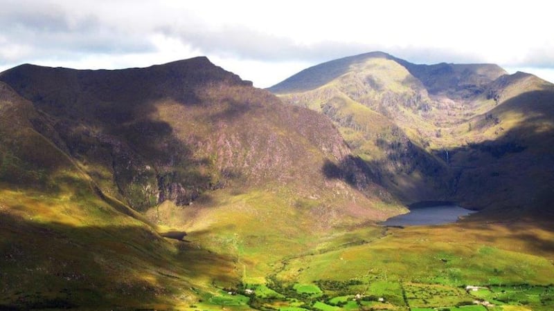
In my view Brandon Ridge is Ireland’s ultimate ridge walk. Some are longer, some have more challenging sections, but none has the entrancing scope of its prospect, from the far reaches of the western horizon to the lofty pinnacles of Macgillycuddy’s Reeks, with a myriad of captivating landscapes in between.
An early start on a ridge walk is desirable both to get to the first summit before the heat builds up and to avoid having to put yourself under pressure at the end of the day.
Although it is tempting to follow the Dingle Way up to the col under Más an Tiompáin, or Masatiompan, it is more interesting to veer over to Binn na mBan, or Beennaman (378m), and follow the edge of the spectacular cliffs as you ascend.
Along the way you will notice a cluster of stone dwellings 500m below you, which, apart from the Skelligs, must be the most remote monastic settlement in the country. I reached the summit of Más an Tiompáin (783m) by 9am, and it was still deliciously cool. The rising sun etched the corrugations of the slopes of the Slieve Mish Mountains and highlighted the sparkling arc of Castlegregory Beach.
The trek to the rocky pinnacle of Piaras Mór, or Pierasmore (748m), is straightforward, and from there around to spot height 891m doesn’t involve any strenuous ascents or descents. Nameless though this point is, it offers a spellbinding view along the knife-edged spine of the Faha Ridge and the 10 gleaming rock-basin lakes vitalising the valley floor under Brandon.
The promontory fort on the ridge reminds one that Christianity arrived here to an existing population steeped in the pagan traditions of the Celts. Here the two traditions melded together, creating the unique nature-based brand of early Irish Christianity.
A short pull brought me on to Brandon Mountain (952m). I lingered here, as this peak has views to savour, from the elegant outline of the Three Sisters to the enigmatic profile of the “Dead Man”, the most northerly of the Blasket Islands, around past the distinctive profile of the Skelligs and along the mountainous profile of Iveragh. The scenes directly below me couldn’t have been more diverse: to the west the jigsaw pattern of stone-walled fields, to the east great cliffs patterned with folded strata from the immense forces unleashed by crustal movements.
From Brandon there is a most enjoyable walk along a clear path to the narrow ridge of Gearhan, with glimpses of the massive boulders broken off the cliffs by frost action and which lie along the slopes of Owenmore valley.
From the col below Gearhane I had my last testing pull on tired legs up to Ballysitteragh (623m), and from there it was downhill all the way. Be careful to follow the line of the spur in order to pick up the track (marked on the map) which leads through some rough ground.
If you are lucky there may be a practice on at the fire station – ask nicely and they may hose you down.
BRANDON RIDGE
Dingle Peninsula, Co Kerry
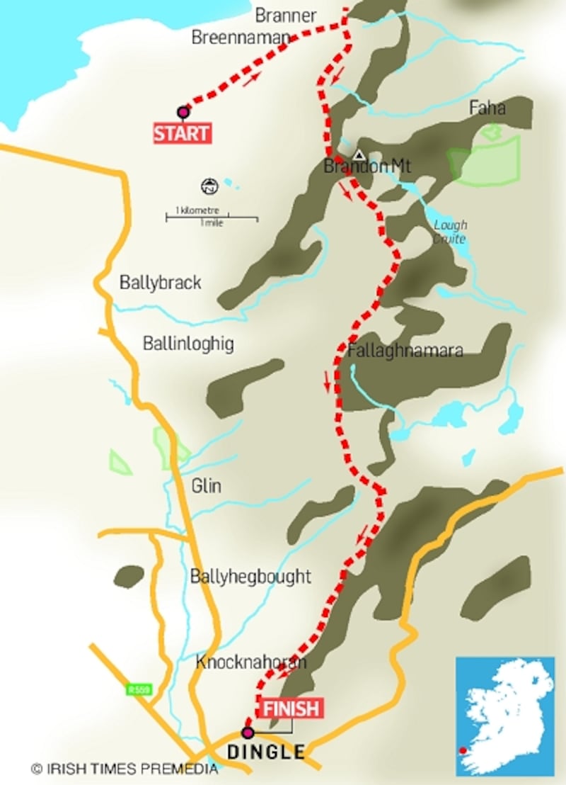
Map Ordnance Survey Discovery Series sheet 70
Start The car park on Slí Chorca Dhuibhne (the Dingle Way), grid reference 432 124
Finish Dingle fire station, grid reference 441 015
How to get there Take the Feohanagh road (the second exit from the Milltown roundabout, at the west end of Dingle). At the first fork, after 8km, go right on to Brandon Creek road. Turn left at the crossroads beyond An Bothar pub and follow the waymarkers for the Dingle Way
Time 8-10 hours
Distance 20km
Total ascent 2,500m
Suitability Hard. Wear good boots and weather-appropriate clothing. Bring energy food. As water is heavy, drink at least two litres before starting


