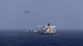
Not long ago, the main benefit of weather forecasts to shipping was timely warning of potentially hazardous gales and storms. Now, however, accurate forecasts are required less to avoid disaster than to exploit future weather conditions to increase profits. Time is money for ocean-going carriers; voyages that are longer or stormier than necessary burn extra fuel, and waste valuable time that could be spent on other ventures.
A technique that allows the total cost of an ocean voyage to be minimised with respect to anticipated weather conditions is known as "weather-routing".
It assumes that a direct route from A to B may not always be the quickest in terms of time; in unfavourable weather, a slightly longer track may bring the ship more quickly to its destination.
To take an obvious example, if the three-day weather forecast shows a deep depression in the middle of the North Atlantic, a ship heading from here to Nova Scotia would be advised to keep to the higher latitudes, enjoying the benefit of a following wind and resulting economies in time and fuel, rather than ply a more southerly track where it would encounter the strong, westerly head-winds blowing around the bottom of the low.
In the early days of weather-routing, the best path was chosen by addressing several tracks. Using a series of charts showing predictions of the future pressure pattern, and hence the winds, for two, three or four days ahead as the case might be, together with technical information about the capabilities of the individual ship, the headway to be expected in each 24-hour period could be reckoned for each of the alternatives.
The route likely to bring the ship to its destination in the shortest time was thus identified.
But the ideal solution is more complex than merely anticipating the likely position of the lows and highs. Resistance to headway in the case of a large modern container ships comes mainly from waves generated by the wind, and from swell, the residual wave-like motion of the surface of the ocean which persists long after the generating winds have died away; comparatively speaking, the resistance due to wind alone is small.
Nowadays, therefore, weather routing involves the use of numerical prediction models which not only provide forecasts of the wind, but also predictions of the height, direction and other characteristics of the waves and swell for several days ahead.
When the technical characteristics of the ship, the departure point and time, and the intended destination, are also provided as an input, the result is a neat print-out of the most economical route computed for the voyage.