The giant boulders in the Glenmacnass River are the stuff of legend, writes DEIRDRE DAVYS
A HILL WALK on a lovely winter’s day does not have to involve maps, compasses or any of the other paraphernalia of the perennial hillwalker. The average Dublin Sunday walker more at home on Dún Laoghaire’s piers or Dollymount Strand can easily pick up the courage to tackle certain stretches of the Wicklow Way without fear of getting lost.
A delightful section of the path starts near Laragh and ends in the centre of Glendalough. This stroll only takes about 80 minutes there and back and is an ideal way to get a sense of the countryside in all its winter beauty.
This is a walk on easy tracks built and managed for the most part by the volunteer group Mountain Meitheal, which last year alone gave up more than 1,500 hours to repair and maintain mountain paths in Ireland.
Your starting point is about a kilometre from Laragh. Take the R115 – the road that leads out of the village towards Sally Gap – and within a few minutes you’ll see a small space for cars on the left-hand side of the road. Park here. Walk downhill, always following the yellow Wicklow Way signs.
Your route takes you through mixed woodland of mountain ash, birch, beech, holly and all manner of native Irish flora. In late winter and early spring the scent of gorse fills the air, and later on in the season you can feast on wild blueberries, or fraughan as they are called in some parts of the country, which grow abundantly along the path.
The boulders in the fast-flowing Glenmacnass River, which you will cross on an ancient wooden bridge, are the stuff of legend. These must be some of the biggest rocks in any river in Wicklow and were no doubt hurled there by Finn Mac Cool and his cronies, probably playing an ancient form of boules.
On the far side of the river, in the dappled shade of moss- covered oaks, the path turns right. Be careful not to miss the way sign almost hidden in the bushes. A few minutes later you emerge from the trees and once again turn right.
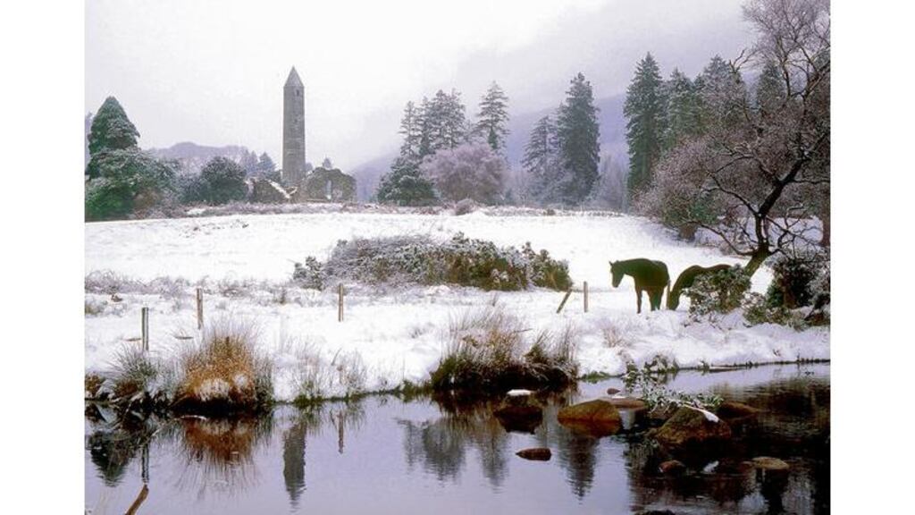
The track now leads you very gently uphill into open countryside, giving lovely views of Long Hill and shortly, in the other direction, of the old stone church in Laragh, before heading down along a grassy path towards Glendalough. For anyone who regularly walks the hills around the Glendalough lakes, coming at the loughs from this direction gives quite a different perspective.
The final kilometre or so leads steeply downhill through bright mixed woodland, past mossy walls of an ancient settlement, past a stand of beech trees that are a delight in autumn, over some well-maintained stiles and into the madness of Glendalough. Nature meets mass tourism.
Should your party be in need of anything from fizzy drinks to shamrocks, they can loiter awhile; otherwise, a quick about-turn is best advised, and within minutes you are once again far from the madding crowd.
Glendalough, Co. Wicklow
- Start and finishCar park on R115 a kilometre from Laragh.
- How to get thereBy car, or take St Kevin's bus to Laragh. At this time of the year, take extreme care driving on the roads. Contact the Garda in Bray (01-6665300), Wicklow (0404-60147) or Blessington (045-865202) for an update on road conditions.
- MapNot necessary.
- DistanceSix or seven kilometres.
- TimeAbout 80 minutes.
- SuitabilityAll ages and fitness levels. But wear warm clothes and be careful in icy conditions.
- Where to stayThere is a hotel and a hostel in Glendalough, and you'll find plenty of accommodation in private houses in and around Laragh.


