THE OTHER-WORLDLY KERRY WAY
Rosita Boland
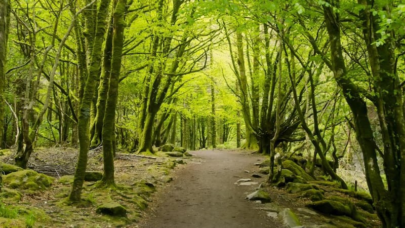
It has been several years since I walked the Kerry Way, but the images of that glorious, deserted place, with its views over the Atlantic, remain utterly clear in my memory.
I walked the Kerry Way in two sections: once on my own; the second time with a partner. The first time was from Killarney to Glenbeigh, via the Black Valley and Glencar; the second time in the opposite direction from Killlarney through Kenmare, Tahilla, Caherdaniel, Waterville and Caherciveen.
That first time was not long after the Berlin Wall came down, and I spent my birthday that year in the Glencar Inn with four East Germans on their first trip out of their country. They were travelling with violins and deadweight rucksacks of canned food they brought from home to save money. They played haunting music all night and spoke of their joy at their new freedom.
The Kerry Way partly follows the old butter roads, tracks that float high over fields that overlook the peninsulas and mercurial colours of the Atlantic. When I returned we swam in rivers and bog holes along the way and met only rabbits, hares and birds. We bitterly regretted not bringing a tent, so that we could camp along the way. We descended each evening to the shock of civilisation and other people and felt like pagans.
The track crossed a remote farm the day we walked to Caherdaniel, and we held our map as we tried to look for the carvings that were marked on it. The farmer saw us, and took us to the field where his grandfather had one day dug turf and discovered dramatic concentric carved stone circles under where the turf finally gave out. Trying to guess how old they were made my head spin.
I loved walking the Kerry Way so much that time that I have not gone back since, for fear of ruining the memories. But that’s crazy talk. I will go back soon, and make new memories of that beautiful, unspoilt, other-worldly wild place.
[ Click here to nominate your own place to go wild.Opens in new window ]
WALKING IN MAYO
Harry McGee

Two of Ireland’s most beautiful valleys take a lot of time and effort to reach, especially if you are travelling from Dublin. But each is worth the long journey 100 times over. You would stand barefoot in snow just to marvel at their eyebright beauty.
One is in southwest Kerry, the other in south Mayo. And both are remote. The Black Valley in Kerry did not get electricity until the 1970s. And human development has made few inroads into the Delphi Valley in Mayo. Both are wonderful for walking, either low or high in the mountains.
You need a good day for Connacht’s highest mountain, Mweelrea, which is a challenging climb from the Delphi Valley, but going in by the northern coum, with its dramatic ramp leading up to Ben Bury, is wonderful. Across the road is Ben Creggan and the broad-topped Sheffries.
If want a slightly less taxing experience, you can walk along the Western Way, a little farther north. From the Leenaun to Westport road, it brings you along the meandering River Eriff, up through forestry to Tawnyard and down the winding Rock Road (carved out of the steep sides of a mountain) that leads into the tiny village of Drummin.
About 300km south, the Kerry Way winds through the Black Valley and its amazing lakes, woodland and wilderness. You can wander through the Gap of Dunloe, or climb Carrauntoohil or Caher from the south, avoiding the eroded and gouged footpaths on the northern side. Or you can continue west into some of the lesser-known reeks or along the Kerry Way. And in the heart of the valley, there’s the wonderful Lord Brandon’s Cottage for refreshments.
[ Click here to nominate your own place to go wild.Opens in new window ]
MYSTERY AND DRAMA OF THE COPPER COAST
Gary Quinn
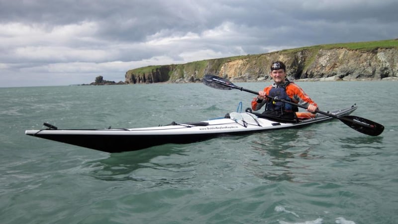
There’s beauty at sea everywhere in Ireland. We are blessed with some of the world’s best sea-kayaking locations, from the wild Atlantic to the marine-rich bottleneck of the Irish Sea.
But of all the routes I’ve paddled here, the one that surprised me most was a 16km route along the Copper Coast in Co Waterford. The coastline gets its name from the 19th-century copper mines that were dug into the coastal soil. Now it's a European geopark that stretches 25km along the coast from Tramore to Dungarvan. It’s a popular walking and bird watching location, but it’s truly dramatic to paddle under its cliffs, into its caves, through the towering sea arches just offshore and under its brooding headlands.
This isn’t a place you visit in search of wild waters: it’s a place full of mystery and drama, and the best conditions are those high-pressure days when the sea is like glass and you can explore unimpeded.
It’s also a great place to have a guide. The caves bring you deep into the earth, twisting and cutting through headlands, but if you don’t know them you can miss them entirely. Or you can retreat, not realising that the darkness ahead hides a secret exit into the next bay.
It's teeming with wildlife: dolphins, whales, porpoises and seals. Drop a line and hook a mackerel. The seabirds overhead will swoop and twirl as you pull it on board. The Copper Coast is wild, dramatic and pure, and not half as well known as it should be. Get on the water and discover it for yourself – and, if you need a guide, find a local at seapaddling.com.
[ Click here to nominate your own place to go wild.Opens in new window ]
ON THE TRAIL OF THE TÁIN IN COOLEY
Laurence Mackin
Only a handful of ancient stories can be traced to specific places in the world: Byblos in Lebanon gave the Bible its name; the remains of ancient Egypt still carry echoes of the rule of Cleopatra. And then there is the Cooley peninsula, Co Louth.
The Táin Bó Cúailnge, or Cattle Raid of Cooley, tells the story of the Connacht queen Maeve’s war against Ulster in the first century. The earliest written example of the story is the Book of the Dun Cow, made 1,000 years later in the monastery at Clonmacnoise, and you can trace the action across the rocky Louth landscape.
Few wild areas can claim the history of this peninsula. From the Long Woman’s Grave to the tip of Slieve Foy, from King John’s Castle to the portal tomb at Proleek, every rock and feature has a story, all the better for being told in the broad strokes of an inimitable Louth accent.
That’s not to say this place lives entirely in the past. Carlingford and its surrounding hills are rough and colourful; it’s a remote place with more than a whiff of bandit country. The Cooley mountains are usually thick with hillwalkers, and the area is threaded with excellent mountain-bike trails. Then there is the lough, one of only three fjords in Ireland. Is there a finer piece of landscape in the country, with mountains on both sides and the promise of fresh oysters and a pint in the peerless PJ O’Hare’s?
[ Click here to nominate your own place to go wild.Opens in new window ]
CAVE-HUNTING IN ANTRIM
Fionola Meredith
No matter how many times you’ve seen it before, it still gives you a rush of exhilaration when you turn a corner on the north Antrim coast road and see the pale gold sweep of White Park Bay stretching out before you, long breakers streaming in endlessly.
In springtime the sand dunes are covered with primroses, the normally solitary flowers springing up in their thousands amid the marram grass. In summer there’s nothing quite as idyllic as lying back in the dunes, watching the red and black burnet moths whizz above your head, a pink blur against the sky.
After the picnic – try boiling potatoes in seawater, which are surprisingly moreish – paddling is obligatory. There are many small, beautiful shells to be found and gathered where the tide bubbles in over your freezing feet, but no swimming: this is a rugged coastline, deceptively friendly in the sunshine, with rough, unpredictable waters.
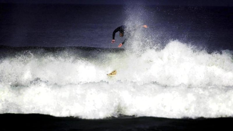
Surfers who know what they’re doing love it, congregating in well-known spots such as Portrush and Portstewart.
If it’s a straightforward swim in the North Atlantic you’re after, Downhill beach – another long strand, more populous than the vast empty stretches of White Park Bay – is the place to go. Surfers, sea-kayakers and assorted boat owners also have access to North Antrim’s hidden sea caves, now all but forgotten, but once a popular Victorian tourist attraction, and the subject of many sinister folk tales.
But if you really want wild and remote, take the little ferry from Ballycastle to Rathlin Island to look for puffins, lapwings and the fabled golden hares.
Don’t be sidetracked by the sedate tea room near the harbour that offers scones with jam and cream. Take a walk to the far side of the island, and you could be in another century.
[ Click here to nominate your own place to go wild.Opens in new window ]
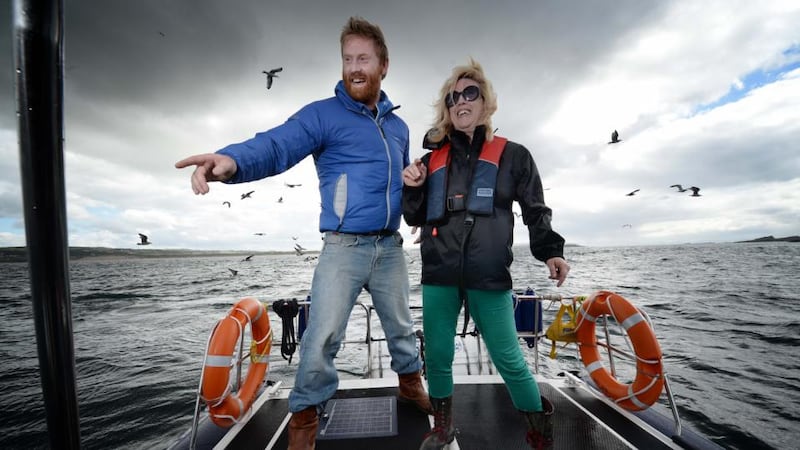
OCEAN-WATCHING IN SLIGO
John Collins
It’s a family tradition that we head to Strandhill, Co Sligo, every June bank holiday for a camping trip with friends. At first glance Strandhill Caravan and Camping Park, which nests in the sand dunes, looks basic, but, actually has great facilities: there’s no point being uncomfortable when you’re going wild.
Once we arrive the children disappear into the dunes, enjoying the kind of freedom that I enjoyed as a child but that seems so hard to achieve in our towns and cities these days.
The surf school at the end of the campsite is run by friendly New Zealanders who manage to have even the most unco-ordinated of us communing with the waves after half an hour.
The pubs, cafes and shops are just a stroll away, but with the village overlooked by Queen Maeve’s grave at the top of Knocknarea and the monastic ruins at the end of the strand they are only really called on in times of bad weather.
Do we fully appreciate the wildness of the Atlantic in this country? Sure, we respect the sea, and maybe even fear it, but I love to face into its rugged beauty and zone out. Sitting on top of a dune, a breeze in my face, watching surfers on longboards catching waves along the headlands, and the sun melting into the ocean in front of me, the stresses and strains of the city may as well be thousands of miles away.
Sleep always comes easily under a sky full of stars with waves crashing nearby.
Feeling inspired? Click here to nominate your own place to go wild.
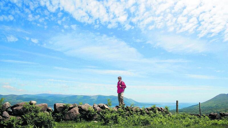
REMOTENESS AND HUMAN HISTORY IN WICKLOW
Paddy Woodworth

Dwyer’s Rock, an outcrop more or less in the middle of Glenmalure, Co Wicklow, gives you panoramic views of the valley in return for a steep 10-minute hike from Coolalingo Bridge. It’s not for the faint-hearted.
There’s only air between the climber and the silver ribbon of the Avonbeg river, meandering 200m below. The circular outlines of early medieval ringforts are clearly if faintly etched on the riverside meadows.
Like any “wilderness” in Ireland, Glenmalure has a past densely populated with human history. Fiach McHugh O’Byrne made the place a nightmare for the Elizabethans. And Michael Dwyer, who gave this lookout rock its name, conducted a guerrilla campaign here long after the rest of the United Irishmen had been defeated in 1798.
Upstream and across the valley, the prospects are desolate, or magically wild, depending on your taste. The bare and massive shoulder of Clohernagh hides an even bigger mountain, Lugnaquillia, the highest peak in the country outside Co Kerry. This is the magnet that draws so many walkers here, but there are many other options, starting with the pleasantly open conifer woods beyond Baravore Ford.
The scree slopes opposite offer an atmosphere of monumental remoteness. Turn a corner, however, and you may find a slagheap or – be very careful here – a mineshaft, another reminder that this place has not been a wilderness for very long.
From Dwyer’s Rock you can connect with the Wicklow Way through forest roads, and follow it backwards, as it were, over Mullacor and into Glendalough, deviating to descend to the upper lake via the Spink. This long but fairly easy walk offers constantly surprising perspectives on both valleys.
Or you could take the well-known “zigzags” on the other side of Glenmalure, crossing the delightful Carrawaystick waterfall on a boardwalk created by Mountain Meitheal.
The most scenic option, however, is to head across the peat hags to the right of Clohernagh’s round summit until you overlook Art’s Lough. If you are lucky with the day, it will glitter like a basket of golden light.
Then you can head back in the opposite direction, dropping down to the hidden jewel of the whole valley, Kelly’s Lough, and wander along the Carrawaystick river, which it feeds, until you are back on the zigzags.
[ Click here to nominate your own place to go wild.Opens in new window ]
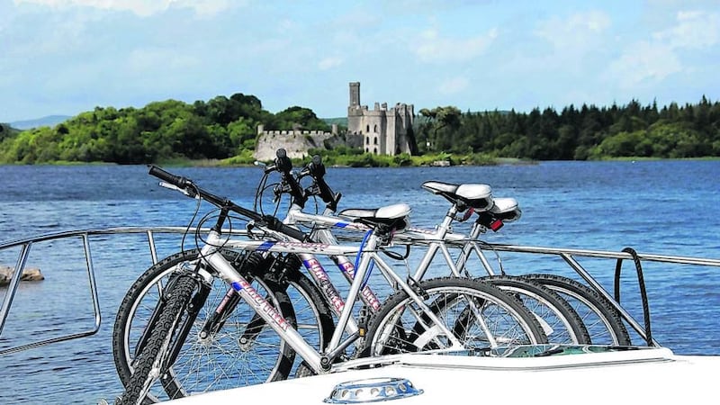
ST EMILION ON THE SHANNON
Tim O'Brien
What sustains me through the dark days of winter is the prospect of sitting on the back of my boat in the fresh air, on a sunny evening, with a glass of Lidl’s St Emilion 2009.
If I am feeling particularly mean about it, the fantasy will involve listening to radio reports of traffic on the M50.
I use the word fantasy here because I know in my heart it probably rains more often than not. But when the sun sparkles on the water, a lazy heron stands on one leg and watches me, when friends are coming down for the weekend, this is what I will remember.
These days my boat the Derrycarne is moored on the River Boyle just below Lough Key, the Killarney of the northwest. Youngsters zipwire through the trees of the forest park, kayak out to the islands, jump off bridges and swing from trees into the water. In the distance a jet ski goes by, heading for Carrick-on-Shannon and its nightlife.
I first discovered Shannon boating on a “lads’ holiday” on Lough Derg, a large lake akin to an inland sea. You can cross it in about an hour to Terryglass, and two hours to Garrykennedy; these names are poetry to me. Magical, serene places, where the boat is always running smoothly and it is always a summer’s evening.
Jet skis are the enemy. Nothing is more infuriating than a dinner upended, or a boat slammed against a quay wall, in the wake of a fast craft already out of sight.
But there are places, wide lakes, for them too. Jet skis and water skis, stag and hen parties, the braying of a rally: all to be assiduously avoided. Unless I am braying myself.
Now, if you’ll excuse me, the season has started.
[ Click here to nominate your own place to go wild.Opens in new window ]