
Super Typhoon Noru was on course to slam into the densely populated main island of Luzon in the Philippines on Sunday night, with forecasters warning of heavy rains and winds that could cause devastating flooding and landslides.
Noru, which is called Karding locally, is likely to make landfall on Sunday night east of Manila, in Quezon or Aurora provinces, with peak winds of about 190km/h (120mph), according to the Philippine Atmospheric, Geophysical and Astronomical Services Administration.
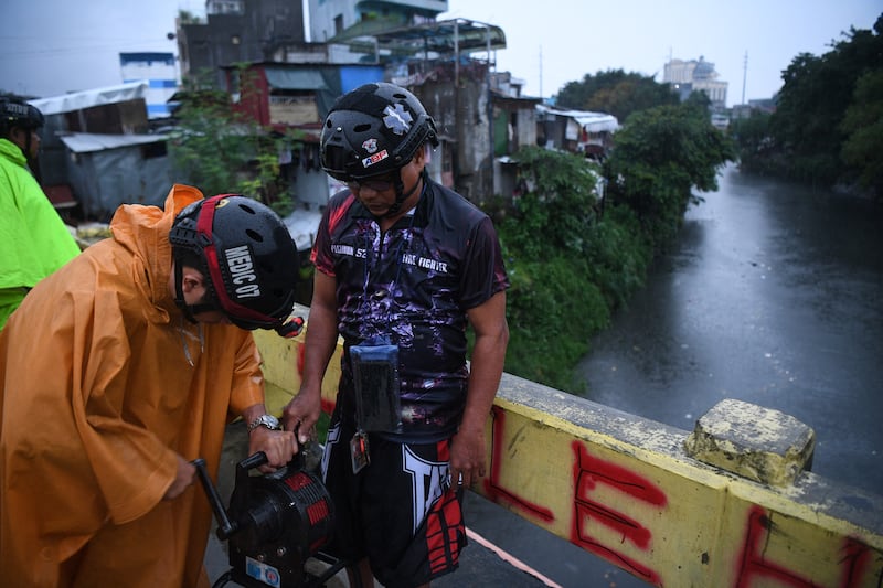
Noru reached “super typhoon category after a period of explosive intensification”, the agency said. Low-lying, exposed areas along the country’s eastern seaboard were warned of a very high risk of storm surge as high as 2.7m (9ft).
By Sunday afternoon the storm’s eye was about 110km east of the coastal city of Infanta in Quezon province, the state weather bureau said. As the typhoon moves over Luzon overnight, some parts of the province – home to some 64 million people, including in metropolitan Manila and outlying suburbs – were expected to experience heavy to intense rains. Luzon makes up the northern third of the country.
Gerry Thornley: Jack Crowley’s patience rewarded as Ireland go in search of Rome revival against Italy

St Patrick’s Day Quiz 2025: 50 questions to test your Irishology

An Irish Diary on memorable gigs from John Denver in the RDS to Bruce Springsteen in Slane

Catherine Fulvio’s St Patrick’s Way review: Glorified advertorial is a blizzard of bland. It’s a disservice to the celebrity chef

Mario Lastares (34), who sells citrus fruits at the Zapote market in Bacoor city, south of Manila, said he would pack up early, go home and start to fortify his little shanty by the river. He planned to stay behind to protect belongings but have his family go to a community shelter nearby.
“We don’t want another Ondoy,” he said, referring to a storm also known as Ketsana, which dumped heavy rains across Manila in 2009, causing extensive flooding and hundreds of deaths. Coincidentally, this week’s typhoon was likely to hit a day shy of the 13th anniversary of Ketsana’s landfall in the Philippines.
Mr Lastares said he remembered that many were caught unprepared by Ketsana, with neighbours using empty plastic gallons and containers as flotation devices. “We were lucky to have survived that,” he said.
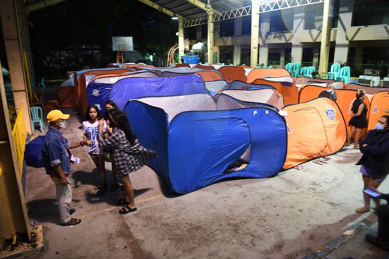
The Philippines’ Office of Civil Defence said Sunday afternoon that fewer than 1,000 people had been pre-emptively evacuated but that local authorities had been working overtime to move people to safety.
Some flights were cancelled, and schools in Manila and surrounding areas were to be closed Monday.
The Philippines is in the Pacific typhoon belt and is struck by an average of 20 storms a year, some of which are devastating. The most powerful storm to hit the country in recent history, Haiyan, was also a super typhoon with winds of at least 240km/h (150 mph). It ravaged the central Philippines in 2013, causing gigantic storm surges and flooding that left more than 6,000 dead.
The terms typhoon, hurricane and cyclone all refer to tropical cyclones; the term applied to a given storm depends on where it originates. Typhoons develop in the northwestern Pacific and usually affect Asia. Hurricanes form in the North Atlantic, the northeastern Pacific, the Caribbean Sea or the Gulf of Mexico.
In the Atlantic, major hurricanes are defined as tropical cyclones with maximum sustained winds of 179km/h (111 mph) or higher and are defined as either category three, four or five storms. But in the Asia Pacific region, there are variations in how individual countries grade typhoons.
The links between tropical storms and climate change are becoming more apparent. Although warming may not lead to more such storms, researchers have found that it has increased the frequency of major ones because a warmer ocean provides more of the energy that fuels them.
– This article originally appeared in The New York Times


