
As a city Dublin is defined by many elements, especially by the enduring presence of the river Liffey, a waterway that in times past fulfilled many roles, from ancient fishery and food source to conduit for trade and movement. In its latter role the Liffey’s utility peaked around the end of the 18th century, a period when it served as one of the city’s principal arteries, a kind of riverine main street.
Paintings and engravings from the period illustrate a vital corridor crowded with shipping along the stretch of quays up to Essex bridge and with the section upriver to Kingsbridge (now Sean Heuston bridge) busy with a regular flow of lighters, barges and crossing ferries. This is a panorama that still presents in many of the world’s great cities: London, Paris, Istanbul, Sydney, New York, Hong Kong – places where river and harbour corridors sustain activity and movement in terms of leisure and commuter traffic.
For Dublin, the waterway’s pre-eminence in terms of transport was reduced from the mid-19th century with the growth of motorised traffic along the quays and the construction of new bridges. Its functional role was finally extinguished with the demise of the famed Guinness barges in the late 1960s.
In more recent decades, however, the process of urban master-planning has signalled some prospect for revival in the fortunes of the Liffey as transport corridor. We can point in particular to Dublin City Council’s 2016 Public Realm Masterplan for the Docklands, which set out as a key objective “the improvement in connectivity between the Docklands and the wider city and development of strategies to animate the areas’ waterbodies”.
READ MORE


The plan referenced a range of new amenities, with allusions to public access facilities including boardwalks both along the river and around Grand Canal Dock. It was proposed that “water animation” would be facilitated through provision of floating pontoons and berthage for boats, both leisure and commercial (boat-based bars, restaurants, etc).
Movement on the river was to be encouraged with references to an expansion of boat services, including water taxis and boat tours on the river and around Dublin Bay – all of this thus mirroring a 2008 vision for the Docklands published by the then Dublin Docklands Development Authority.
This proposed the development of a commuter water taxi service operating between Pigeon House Harbour, close to the former Georgian hotel, and Sir John Rogerson’s Quay.
Perhaps predictably, however, these ambitious visions outran the council’s capacity to deliver and, as of today, few if any of the promised waterside or maritime interventions have materialised.
More recently, the new City Transport Plan represents the latest iteration in a seemingly endless planning cycle. More constructively perhaps, this latest planning framework presents a new opportunity to consider water-based transport as a potential remedy for gridlock and congestion.
Specifically in the context of the transport plan, a water taxi commuter service has scope to deliver a fast, affordable and energy-efficient link between Docklands and adjoining residential areas. This is an opportunity that’s newly recognised in Belfast city, where the authorities have adopted a private sector plan for a fast hydrofoil service linking the city’s docklands with the seaside town of Bangor.
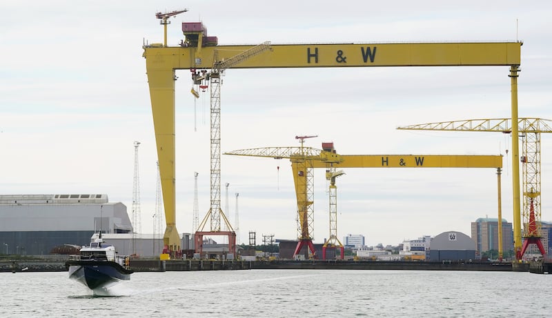
What’s envisaged is an innovative, electrically powered vessel with capacity to provide a regular, rapid alternative link along Northern Ireland’s busiest commuter corridor. The service is planned for introduction this year and will result in typical journey times being cut by as much as two-thirds.
The real opportunity would relate to the emergence the Poolbeg peninsula as a high-density residential and commercial zone, catering for a population of up to 10,000 people
In the case of Dublin, we could envisage a service operating from a riverside base close to the Poolbeg West development site – a new, emerging suburb. This could be either the adjacent Pigeon House Harbour, beside the twin chimneys, or at Poolbeg Marina, just downstream from the Eastlink bridge.
The upriver termination point would be located at either the existing Jeanie Johnston pontoon at North Wall or at a new facility on the opposite South bank.
[ New €18m ‘water activities centre’ planned for Dublin’s docklandsOpens in new window ]
[ Docklands companies call for Dublin port to be movedOpens in new window ]
The distance between origin and destination is just over 3km, representing a transit time of about 10 minutes.
It’s important to emphasise that only very limited demand for such a service would exist at present and the real opportunity would relate to the emergence the Poolbeg peninsula as a high-density residential and commercial zone, catering for a population of up to 10,000 people.
Similarly to Belfast, the service can be developed on a zero-emissions basis through the use of battery-electric propulsion and using a green energy source, ideally solar. In the fullness of time, there would also be potential to utilise always-available tidal energy at source.
This zero-emissions feature is probably the project’s standout feature, distinguishing this mode of transport from other high-emissions alternatives.
Politicians take note – every element in this proposal is consistent with Dublin City Development Plan Sustainable Mobility and Transport policies, including the 15-minute city, compact growth, utilisation of green energy and reduced transport emissions.
Reg McCabe is public relations officer of voluntary body the Inland Waterways Association of Ireland (Dublin branch)
- Sign up for push alerts and have the best news, analysis and comment delivered directly to your phone
- Find The Irish Times on WhatsApp and stay up to date
- Our In The News podcast is now published daily – Find the latest episode here


