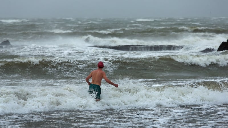
Met Éireann has urged citizens on the west coast to "take action" to protect themselves and their properties as the most concentrated levels of rainfall in decades are expected over the course of Saturday.
ESB Networks crews have been working to restore power to thousands of households suffering power outages, and currently less than 2,000 remain without electricity.
Many of these are on the west coast, which is being battered by Storm Desmond.
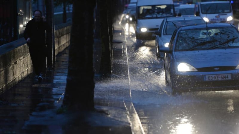
There has also been some disruption to flights with Aer Lingus reporting some of its regional services have been cancelled. There were reports earlier that several flights had been forced to circle above Dublin Airport as high winds made it too dangerous to land.
The National Co-ordination Group for Severe Weather Emergencies met on three occasions on Friday to assess flood threats and ensure a co-ordinated cross-departmental response from the Government and State agencies.
Met Éireann issued a status red rainfall warning for Connacht, Donegal, Clare and Kerry, urging citizens to “take action to protect themselves and their properties” either by moving out of danger zones temporarily or by staying indoors.
The warning is in place until 3am on Sunday, and accumulations of between 70mm and 100mm of rain are expected in the worst-affected areas. A typical weather front brings about 10mm of rainfall.
Status orange rainfall warnings are in place for Cavan, Cork and Limerick, while there is a status orange wind warning in place for Donegal, Galway, Leitrim, Mayo, Sligo and Clare.
Flooding risk
Met Éireann head of forecasting Gerald Fleming said it was a matter for individuals to make decisions in relation to leaving their homes. “It will depend on whether their homes are susceptible to flooding,” he said. “If they are low-lying or beside a fast running stream which could rise very quickly - that could happen.”
He said Storm Desmond would be a “once in several decades” event for many parts of the State, and that there could be “several weeks” of flooding ahead.
“It’s really exceptional,” he said. “We’re talking a month’s rainfall over the course of 36 hours, which could equate to 100mm of rain. Depending on what part of the northwest you’re in, that is a one in 20 or a one in 50 year event.
“Donegal, Mayo and Galway will be the three counties that will get the worst of it but it will also be felt quite severely in Clare and Kerry. Higher ground in Limerick, north Tipperary, Roscommon, Leitrim, western Cavan, will all pick up a lot of rain.
“Over the following three or four days, the rivers will rise. Depending on the river, they could rise very quickly, but it could be a week before the full extent is seen. Flooding will be quite a problem not just over the next 36 hours, but for some weeks.”
Non-essential travel
The national group for weather emergencies said in a statement “very dangerous conditions” could emerge and that citizens in affected areas should avoid non-essential travel.
Gardaí have described driving conditions as “challenging” and fallen trees have been reported in several areas.
The Road Safety Authority (RSA) issued a statement urging all road users to take care.
"The public is advised to check local weather and traffic reports and heed any advice from local councils and An Garda Síochána regarding road conditions," it said.
It added motorists should slow down and allow extra time for travel.
The local authorities will co-ordinate with the Garda and the HSE to deal with the impact of the high winds and heavy rainfall.
Flooding advice is available on flooding.ie