
Met Éireann has issued a warning over thunderstorms and the possibility of flash flooding for counties in Leinster and parts of the midlands.
It said thundery showers are expected to be heavy and widespread this afternoon in parts of Dublin, Kildare, Louth, Wexford, Wicklow, Meath, Cavan and Monaghan. The heaviest rainfall is expected between 1pm and 6pm today.
Temperatures will range from 17 to 20 degrees, with moderate to fresh west and southwest winds expected.
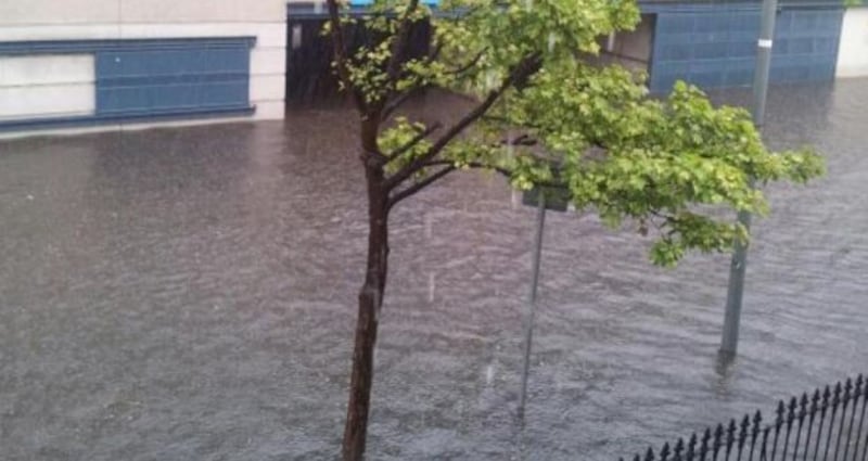
Exceptionally heavy rain on Friday led to flooding in parts of Dublin, with Croke Park and Jones's Road affected, and in Co Donegal where part of Letterkenny General Hospital was flooded.
The flooding also caused problems for commuters with a lightning strike on the Luas line at Beechwood resulting in the suspension of services between Beechwood and St Stephen’s Green.
Motorists were also affected last week by flooding in Templeogue village and near the Docklands train station.
The outlook for the rest of the week is for little change, with the weather remaining unsettled and a risk of heavy downpours and scattered thunderstorms.
In between the showers, there will be warm bursts of sunlight, with temperatures a degree or two above normal for the time of year.
Showers are expected to die down somewhat tonight, although they are likely to linger along coastal areas of the west and south.
The occasional heavy showers, which were a feature of yesterday, were to die out last night and become confined to coastal counties of the south and west. Lowest temperatures were to fall to between 11 and 14 degrees, with some mist and light winds expected.
Tomorrow will have a dry start in many areas, but there is the likelihood of some thundery and heavy showers.
A spell of heavy rain will develop in the southwest later in the day, spreading northwards later with scattered thunderstorms and a risk of flooding.
The wind is expected to pick up too as light southerly winds become westerly for a time.
The forecast for Wednesday is for unsettled weather, with a risk of heavy, thundery rain.
It will be humid, with temperatures reaching the low 20s or possibly mid-20s. There is more rain predicted for Thursday, mainly in the southeast with drier weather likely further west.


